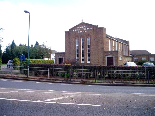
Broadway United Reformed Church
Getting here
52.57755, -1.96058
Visiting this summer
Seasonal nature notes and what to look for now
Visiting this summer
Seasonal nature notes and what to look for now
- 🌞Midsummer — early morning visits most comfortable; look for deer fawns in quieter clearings
- 🐕Early mornings are best for dog walks in summer — visit before 9am to avoid the heat and find quieter trails
- 🅿️Parking 286m away — 10 car parks within reach
🌤️ Visiting this summer
- 🌞Midsummer — early morning visits most comfortable; look for deer fawns in quieter clearings
- 🐕Early mornings are best for dog walks in summer — visit before 9am to avoid the heat and find quieter trails
- 🅿️Parking 286m away — 10 car parks within reach
Good to know
- £Free to visit — no entry charge
- 🐕Dogs welcome
Best for
Dog walks
Good match
Dogs allowed with public access
Cycling
Good match
Named cycling route nearby: [PROPOSED]Starley Regional Cycle Network
Heritage
Moderate match
Religious grounds — local heritage
Trails nearby
Within roughly 5 km🚶Walking
7 signed routes nearby
Signed route nearby
Walking
Monarch's WayWalking route990 km
approximate route of Charles II's escape
Paupers Memorial TrailWalking route6 km
Trail following history of Paupers in West Bromwich from the first dispensers of poor relief by monks at Sandwell Priory to the Poor Law Workhouse and burial site.
Beacon WayWalking route40 km
Starting at Sandwell Valley via the outskirts of Birmingham and the countryside of Walsall into Staffordshire. Take in the Forest of Mercia, lakes, nature reserves, woods, and canal banks. Named after Barr Beacon, one of the highest hills in this area.
Walsall Walk of ArtWalking route6.5 km
A specially designed circular canalside walk, starting from Walsall’s New Art Gallery, passing through changing landscapes. Distance: 4 miles/6.5 km(approx) Duration: 80 mins(approx)
Walk Wednesbury Heritage TrailWalking route
Heritage trail around Wednesbury, named after the Saxon god Woden, grew from a 10th c rural land into a major industrial hub. Globally known for pottery, enamelling & ironwork. Fortified by Ethelflaed, its rich history is now rediscovered via archaeology.
🚴Cycling
71 signed routes nearby
Signed route nearby
Cycling
SCWIP Cycle Route 15Cycling route
McClean WayCycling route
[PROPOSED]Starley Regional Cycle NetworkCycling route804 km
Starley (TfWM) Regional Cycle Network (Proposed route)
Sneyd Junction to Cannock Extension CanalCycling route8.8 km
A semi-rural route following the curves of the canal, until it opens out into parkland at the Cannock Extension. Distance: 5.5 miles/8.8 km (approx) Duration: 45 min (approx)
Cannock Extension Canal to Longwood JunctionCycling route11.2 km
Canalside route leading past Clayhanger Common and through Rushall, with a pub along the way. Distance: 7 miles/11.2 km (approx) Duration: 60 min (approx)
SCWIP Cycle Route 7Cycling route
Wildlife to spot
Photos
Weather for this location
Loading local forecast…
Nearby places
Useful places within 5 km
Own or manage this place?
Claim this listing to keep details accurate, add photos, and highlight what makes it special — free.
Claim this pageHow was your visit?
How useful was the information on this page?
id: fbfd9809-de77-42fc-b812-f0dfd437f9e4