🦅 Birds🦉 Wildlife🦋 Insects
↑ Share
Free entry Dogs welcome 7 ha
Places › England › West Midlands › Lichfield Getting here
52.60239, -1.77429
Open directionsv Visiting this summer
Seasonal nature notes and what to look for now
▾ 🐦 82+ species recorded in this area — summer evenings are best for activity; watch for Shoveler and Pochard 🌿 Foraging is at its best in summer here 🐕 Dogs welcome — bring water in summer; the site has enough space to find shade on hot days 🌤️ Visiting this summer
🐦 82+ species recorded in this area — summer evenings are best for activity; watch for Shoveler and Pochard 🌿 Foraging is at its best in summer here 🐕 Dogs welcome — bring water in summer; the site has enough space to find shade on hot days £ Free to visit — no entry charge🐕 Dogs welcome🦅 Bird watching
Very strong match
Birds — Shoveler, Pochard, Wigeon +79 more · last seen 2025; Birds — Shoveler, Pochard, Wigeon +79 more · last seen 2025
Free
🦉 Wildlife
Very strong match
Multi-group wildlife — Birds, Mammals; Multi-group wildlife — Birds, Mammals
Free
🦋 Insect spotting
Strong match
Insects — Peacock, Green-veined White, Red Admiral +40 more · last seen 2020; Insects — Peacock, Green-veined White, Red Admiral +40 more · last seen 2020
Free
Deciduous woodland — fungi, berries and wild garlic
Varies
🍄 Mushroom foraging
Good match
Fungi — Chicken Of The Woods · last seen 2018; Fungi — Chicken Of The Woods · last seen 2018
Varies
🍂 Seasonal nature
Moderate match
Plants — Rhododendron · last seen 2019; Plants — Rhododendron · last seen 2019
Free
Trails nearby Within roughly 5 km 10 signed routes nearby
Signed route nearby
Heart of England Way Walking route ▾
Named route Listed length 161km Regional walking route
Show on map Sutton Park Archeology Walk 5: Blackroot Bistro Walking route ▾
Most of Sutton Park is a Scheduled Ancient Monument and contains archaeological remains. This trail, one of six in the park, is via an 18th-century racecourse and golf course, medieval deer park, and quarry created for an 18th-century mill pond dam.
Named route Ref AW5BB Round trip Local walking route
Show on map Sutton Park Archeology Walk 6: Bracebridge Pool Walking route ▾
Most of Sutton Park is a Scheduled Ancient Monument and contains archaeological remains. This trail, one of six in the park, is via a medieval fish pond, 16th-century wood, WWI military practice trenches, mysterious earthwork, and 19th-century estate.
Named route Ref AW6BP Round trip Local walking route
Show on map The Tame Way- Canal Route Walking route 19 km ▾
Explore the views, history and wildlife of the Tame Valley Wetlands. Stretching between Birmingham and Tamworth is an extraordinary hidden landscape on the doorstep of over 1 million people.
Sister walk to a river walk also ending at Hopwas.
Duration ~5h
Named route Ref TW-C Length 19 km Point-to-point Local walking route
Show on map E2 hiking trail Birmingham Walking route ▾
Named route National walking route
Show on map 37 signed routes nearby
Signed route nearby
North Birmingham Walking and Cycling Route Cycling route ▾
Route 535 is a small cycle route from National Cycle Route 5 in Birmingham City Centre to Gravelly Hill, which carries on for a short way along the Tame Valley Canal
Named route Ref 535 National Cycle Network
Show on map National Cycle Network Route 534 Cycling route ▾
Named route Ref 534 National Cycle Network
Show on map New Hall Valley Cycle Route Cycling route ▾
Named route Ref 534 National Cycle Network
Show on map Connect2 Cycling route ▾
Named route Local cycle route
Show on map Main Route Cycling route 445 m ▾
Named route Ref 534 Length 445 m National Cycle Network Traffic-free Surface asphalt
Show on map N/A Cycling route 83 m ▾
Named route Length 83 m National Cycle Network On-road Surface asphalt
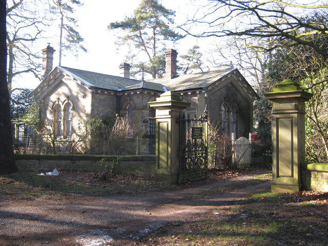
Show on map Photos Gatehouse to Canwell Hall
‹ ›
Weather for this location Next 14 days Nearby places Useful places within 5 km
Own or manage this place?
Claim this listing to keep details accurate, add photos, and highlight what makes it special — free.
Claim this page→ Visitor access unverified. We don't yet have confirmed information about walking routes or public access at this reservoir. If you've visited, please help us improve this page.
How useful was the information on this page?
Something wrong on this page?
id: 71ebcecc-813d-42c4-9abd-0b6925941748
UK green spaces mapped from open public data — so anyone can find the woodland, trail, or nature reserve closest to them.
© 2026 Glade · Made with care for UK green spaces
Events & activities nearby Switch provider to compare local events, tours and bookable activities.
Bookable tours GetYourGuide Promote here
Wildlife to spot
1,212 records · National Biodiversity Network
▾
Wildlife to spot 1,212 records · National Biodiversity Network 🐦 Birds 35 species
spring summer autumn winter
2025 ▾
Shoveler · Pochard · Wigeon · Mallard · Dunnock +30
Shoveler Spatula clypeata Pochard Aythya ferina Wigeon Mareca penelope Mallard Anas platyrhynchos Dunnock Prunella modularis Woodpigeon Columba palumbus House Sparrow Passer domesticus Black-headed Gull Chroicocephalus ridibundus Jackdaw Coloeus monedula Greenfinch Chloris chloris Blackbird Turdus merula Robin Erithacus rubecula Carrion Crow Corvus corone Pied Wagtail Motacilla alba yarrellii Merlin Falco columbarius2024 Herring Gull Larus argentatus2023 Blue Tit Cyanistes caeruleus2023 Chiffchaff Phylloscopus collybita Swallow Hirundo rustica Goldfinch Carduelis carduelis Chaffinch Fringilla coelebs Long-tailed Tit Aegithalos caudatus Greylag Goose Anser anser Raven Corvus corax2024 Grey Heron Ardea cinerea2023 Moorhen Gallinula chloropus2023 Green Woodpecker Picus viridis2023 Great Tit Parus major2023 Wren Troglodytes troglodytes2023 Little Ringed Plover Charadrius dubius2023 Mute Swan Cygnus olor2022 Magpie Pica pica2022 Rook Corvus frugilegus2022 Canada Goose Branta canadensis2022 Stock Dove Columba oenas2022 Badger · Soprano Pipistrelle · Common Pipistrelle · Brown Long-eared Bat · Otter +2
Badger Meles meles2025 Soprano Pipistrelle Pipistrellus pygmaeus2022 Common Pipistrelle Pipistrellus pipistrellus2022 Brown Long-eared Bat Plecotus auritus2022 Otter Lutra lutra Myotis Bat species Myotis Red Clover · Hogweed · Common Sorrel · Cow Parsley · Soft-brome +74
Red Clover Trifolium pratense Hogweed Heracleum sphondylium Common Sorrel Rumex acetosa Cow Parsley Anthriscus sylvestris Soft-brome Bromus hordeaceus Annual Meadow-grass Poa annua Dandelion Taraxacum Species observations from the last 10 years via NBN Atlas
2022
2022
Long-eared Bat species Plecotus2022
Long-eared Bat species Plecotus2022
Bramble Rubus fruticosus
Bramble Rubus fruticosus
Meadow Buttercup Ranunculus acris
Meadow Buttercup Ranunculus acris
Common Bird's-foot-trefoil Lotus corniculatus
Common Bird's-foot-trefoil Lotus corniculatus
Field Wood-rush Luzula campestris
Field Wood-rush Luzula campestris
Bulbous Buttercup Ranunculus bulbosus
Bulbous Buttercup Ranunculus bulbosus
Curled Dock Rumex crispus
Curled Dock Rumex crispus
Gorse Ulex europaeus
Gorse Ulex europaeus
Meadow Foxtail Alopecurus pratensis
Meadow Foxtail Alopecurus pratensis
Elder Sambucus nigra
Elder Sambucus nigra
Rough Meadow-grass Poa trivialis
Rough Meadow-grass Poa trivialis
Cock's-foot Dactylis glomerata
Cock's-foot Dactylis glomerata
Rowan Sorbus aucuparia2024
Rowan Sorbus aucuparia2024
Black Medick Medicago lupulina
Black Medick Medicago lupulina
Garlic Mustard Alliaria petiolata
Garlic Mustard Alliaria petiolata
Hairy Tare Ervilia hirsuta
Hairy Tare Ervilia hirsuta
Pedunculate Oak Quercus robur
Pedunculate Oak Quercus robur
Common Ragwort Jacobaea vulgaris
Common Ragwort Jacobaea vulgaris
Soft-rush Juncus effusus
Soft-rush Juncus effusus
Beaked Hawk's-beard Crepis vesicaria
Beaked Hawk's-beard Crepis vesicaria
White Clover Trifolium repens
White Clover Trifolium repens
Ribwort Plantain Plantago lanceolata
Ribwort Plantain Plantago lanceolata
Yarrow Achillea millefolium
Yarrow Achillea millefolium
Musk-mallow Malva moschata
Musk-mallow Malva moschata
Ivy Hedera helix
Ivy Hedera helix
Perforate St John's-wort Hypericum perforatum
Perforate St John's-wort Hypericum perforatum
Greater Plantain Plantago major
Greater Plantain Plantago major
Cleavers Galium aparine
Cleavers Galium aparine
Lesser Celandine Ficaria verna
Lesser Celandine Ficaria verna
Silver Birch Betula pendula
Silver Birch Betula pendula
Cat's-ear Hypochaeris radicata
Cat's-ear Hypochaeris radicata
Centaurea nigra Centaurea nigra
Centaurea nigra Centaurea nigra
Germander Speedwell Veronica chamaedrys
Germander Speedwell Veronica chamaedrys
Lesser Trefoil Trifolium dubium
Lesser Trefoil Trifolium dubium
Hawthorn Crataegus monogyna
Hawthorn Crataegus monogyna
Cut-leaved Crane's-bill Geranium dissectum
Cut-leaved Crane's-bill Geranium dissectum
Great Willowherb Epilobium hirsutum
Great Willowherb Epilobium hirsutum
Field Forget-me-not Myosotis arvensis
Field Forget-me-not Myosotis arvensis
Creeping Cinquefoil Potentilla reptans
Creeping Cinquefoil Potentilla reptans
Ash Fraxinus excelsior
Ash Fraxinus excelsior
Broad-leaved Dock Rumex obtusifolius
Broad-leaved Dock Rumex obtusifolius
Daisy Bellis perennis
Daisy Bellis perennis
Shining Crane's-bill Geranium lucidum
Shining Crane's-bill Geranium lucidum
Field Maple Acer campestre
Field Maple Acer campestre
Danish Scurvygrass Cochlearia danica
Danish Scurvygrass Cochlearia danica
Groundsel Senecio vulgaris
Groundsel Senecio vulgaris
Common Mallow Malva sylvestris
Common Mallow Malva sylvestris
Bush Vetch Vicia sepium
Bush Vetch Vicia sepium
Bee Orchid Ophrys apifera
Bee Orchid Ophrys apifera
False Oat-grass Arrhenatherum elatius
False Oat-grass Arrhenatherum elatius
Hoary Willowherb Epilobium parviflorum
Hoary Willowherb Epilobium parviflorum
Spear Thistle Cirsium vulgare
Spear Thistle Cirsium vulgare
White Bryony Bryonia dioica
White Bryony Bryonia dioica
Creeping Buttercup Ranunculus repens
Creeping Buttercup Ranunculus repens
Festuca rubra Festuca rubra
Festuca rubra Festuca rubra
Beech Fagus sylvatica
Beech Fagus sylvatica
Sweet Vernal-grass Anthoxanthum odoratum
Sweet Vernal-grass Anthoxanthum odoratum
Buck's-horn Plantain Plantago coronopus
Buck's-horn Plantain Plantago coronopus
Rough Hawkbit Leontodon hispidus
Rough Hawkbit Leontodon hispidus
Smooth Sow-thistle Sonchus oleraceus
Smooth Sow-thistle Sonchus oleraceus
Compact Rush Juncus conglomeratus
Compact Rush Juncus conglomeratus
Common Vetch Vicia sativa
Common Vetch Vicia sativa
Oxeye Daisy Leucanthemum vulgare
Oxeye Daisy Leucanthemum vulgare
Green Alkanet Pentaglottis sempervirens
Green Alkanet Pentaglottis sempervirens
White Dead-nettle Lamium album
White Dead-nettle Lamium album
Creeping Thistle Cirsium arvense
Creeping Thistle Cirsium arvense
Common Bent Agrostis capillaris
Common Bent Agrostis capillaris
Scots Pine Pinus sylvestris
Scots Pine Pinus sylvestris
Mugwort Artemisia vulgaris
Mugwort Artemisia vulgaris
Common Nettle Urtica dioica
Common Nettle Urtica dioica
Common Mouse-ear Cerastium fontanum
Common Mouse-ear Cerastium fontanum
Holly Ilex aquifolium2024
Holly Ilex aquifolium2024
Honeysuckle Lonicera periclymenum2024
Honeysuckle Lonicera periclymenum2024