Cullompton Community Association Fields
Getting here
50.85548, -3.38739
Visiting this summer
Seasonal nature notes and what to look for now
Visiting this summer
Seasonal nature notes and what to look for now
- 🌞Midsummer — early morning visits most comfortable; look for deer fawns in quieter clearings
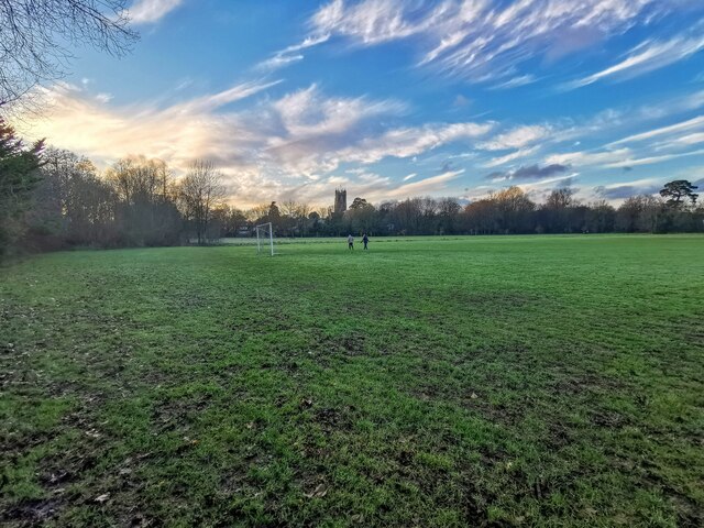
- ⚽Playing fields is at its best in summer here
- 🛝Playground 230m away — built-in entertainment for younger visitors alongside the wider site
🌤️ Visiting this summer
- 🌞Midsummer — early morning visits most comfortable; look for deer fawns in quieter clearings
- ⚽Playing fields is at its best in summer here
- 🛝Playground 230m away — built-in entertainment for younger visitors alongside the wider site
Good to know
- 🐕Dogs welcome
Best for
Wildlife
Very strong match
Multi-group wildlife — Amphibians, Birds, Mammals; Multi-group wildlife — Amphibians, Birds, Mammals
Bird watching
Very strong match
Birds — Woodpigeon, Blackbird, Herring Gull +55 more · last seen 2025; Birds — Woodpigeon, Blackbird, Herring Gull +55 more · last seen 2025
Playing fields
Very strong match
Playing field
Playgrounds
Strong match
playground, parking
Family friendly
Strong match
playground; Playing field
Dog walks
Good match
Dogs allowed with public access
Trails nearby
Within roughly 5 km🚶Walking
7 signed routes nearby · 32 public paths nearby
Signed route nearbyPublic paths
Walking
Two Counties WayWalking route90 km
A long distance walk of 56 miles (90km) from Taunton to Starcross on the Exe estuary.
Cullompton Honiton WalkWalking route
Bradninch Town TrailWalking route
Uffculme Village TrailWalking route
Willand Village TrailWalking route
Middle Mill Lanepublic footpath · 217 m
Higher Mill Lanepublic footpath · 43 m
Higher Mill Lanepublic footpath · 95 m
🚴Cycling
6 signed routes nearby
Signed route nearby
Cycling
NCN 3 Link to Tiverton ParkwayCycling route
Route 3Cycling route527.7 km
Main RouteCycling route200 m
Main RouteCycling route981 m
Main RouteCycling route725 m
N/ACycling route891 m
🐴Horse riding
9 public paths nearby
Public paths
Horse riding
Goblin Lanebridleway · 147 m
Shortlands Lanebridleway · 57 m
Shortlands Lanebridleway · 54 m
Shortlands Lanebridleway · 58 m
Goblin Lanebridleway · 709 m
Wildlife to spot
Photos
Weather for this location
Loading local forecast…
Nearby places
Useful places within 5 km
Own or manage this place?
Claim this listing to keep details accurate, add photos, and highlight what makes it special — free.
Claim this pageHow was your visit?
How useful was the information on this page?
id: a5fd97d0-955f-4155-828c-39fe4f3e3e9c