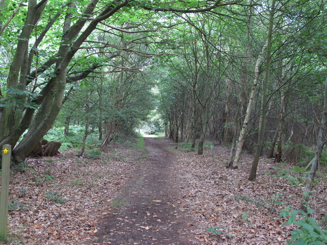
Dodnash Wood ✦ Ancient woodland 29 ha
🦉 Wildlife🦅 Birds🍂 Seasonal
↑ Share
Public access Free entry Dogs welcome 29 ha
Places › England › Eastern › Babergh Getting here
51.98326, 1.06546
Open directionsv Visiting this summer
Seasonal nature notes and what to look for now
▾ 🌞 Midsummer — early morning visits most comfortable; look for deer fawns in quieter clearings 🐕 Early mornings are best for dog walks in summer — visit before 9am to avoid the heat and find quieter trails 🅿️ Parking 426m away — 6 car parks within reach 🌤️ Visiting this summer
🌞 Midsummer — early morning visits most comfortable; look for deer fawns in quieter clearings 🐕 Early mornings are best for dog walks in summer — visit before 9am to avoid the heat and find quieter trails 🅿️ Parking 426m away — 6 car parks within reach £ Free to visit — no entry charge🐕 Dogs welcome🌿 Ancient woodland — rare wildlife habitat🦉 Wildlife
Very strong match
Multi-group wildlife — Birds, Mammals, Reptiles; Multi-group wildlife — Birds, Mammals, Reptiles
Free
🦅 Bird watching
Very strong match
Birds — Carrion Crow, Woodpigeon, Blackcap +80 more · last seen 2025; Birds — Carrion Crow, Woodpigeon, Blackcap +80 more · last seen 2025
Free
🍂 Seasonal nature
Strong match
Ancient woodland — bluebells, fungi and autumn colour; Plants — Black Horehound, Green Alkanet, Walnut +41 more · last seen 2026
Free
🦋 Insect spotting
Strong match
Insects — Stag Beetle, Azure Damselfly, Broad-bodied Chaser +73 more · last seen 2025; Insects — Stag Beetle, Azure Damselfly, Broad-bodied Chaser +73 more · last seen 2025
Free
Dogs allowed — public woodland
Free
Deciduous woodland — fungi, berries and wild garlic; Plants — Walnut, Garlic Mustard, Bristly Oxtongue +1 more foraging species
Varies
Trails nearby Within roughly 5 km 8 signed routes nearby · 15 public paths nearby
Signed route nearby Public paths
Alton Water Red Route Walking route ▾
Named route Local walking route
Show on map Stour Valley Path part 3 Walking route ▾
Named route Regional walking route
Show on map Flatford and Constable Country Walk, Flatford Walking route 11.2 km ▾
4 miles (6.4km) return from Manningtree to Flatford. Optional loop to Dedham adds another 3 miles (4.8km). Generally flat grass and gravel paths with some moderate slopes.
Named route Length 11.2 km Duration 03:30 Round trip Local walking route
Show on map St Edmund Way Walking route ▾
Named route Listed length 142km Regional walking route
Show on map Stour & Orwell Walk Walking route ▾
Named route Regional walking route
Show on map 11 signed routes nearby
Signed route nearby
South Suffolk Route B Cycling route ▾
Named route Ref B Regional cycle route
Show on map Alton Water Loop Cycling route ▾
Named route Local cycle route
Show on map South Suffolk Route B2 Cycling route ▾
Named route Ref B2 Regional cycle route
Show on map South Suffolk Route B1 Cycling route ▾
Named route Ref B1 Regional cycle route
Show on map NCN National Route 1 Cycling route ▾
Named route Ref 1 National Cycle Network
Show on map EuroVelo 12 - North Sea Cycle Route - part United Kingdom 1 Cycling route ▾
Named route Ref EV12 International cycle route
Show on map 2 public paths nearby
Public paths
Link Lane bridleway · 157 m ▾
Public path bridleway Length 157 m Surface gravel Path type: track
Show on map ✦ Ancient woodland — continuously wooded since at least 1600 AD. A rare and irreplaceable habitat, rich in biodiversity and historical character.
Weather for this location Next 14 days Nearby places Useful places within 5 km
All Historic
Own or manage this place?
Claim this listing to keep details accurate, add photos, and highlight what makes it special — free.
Claim this page→ How useful was the information on this page?
Something wrong on this page?
id: ab7ceb2f-4a97-4d6f-8bbe-70f1dee79e50
UK green spaces mapped from open public data — so anyone can find the woodland, trail, or nature reserve closest to them.
© 2026 Glade · Made with care for UK green spaces
Wildlife to spot
29,505 records · National Biodiversity Network
▾
Wildlife to spot 29,505 records · National Biodiversity Network Woodpigeon · Carrion Crow · Magpie · Rook · Jackdaw +32
Woodpigeon Columba palumbus Carrion Crow Corvus corone Magpie Pica pica Rook Corvus frugilegus2024 Jackdaw Coloeus monedula2024 Pheasant Phasianus colchicus2024 Blackcap Sylvia atricapilla Mute Swan Cygnus olor2024 Chiffchaff Phylloscopus collybita2024 Starling Sturnus vulgaris2024 Great Spotted Woodpecker Dendrocopos major2024 Black-headed Gull Chroicocephalus ridibundus2024 Robin Erithacus rubecula2024 Collared Dove Streptopelia decaocto2024 Coal Tit Periparus ater2024 Green Woodpecker Picus viridis2023 Kestrel Falco tinnunculus2023 Swallow Hirundo rustica2024 Lesser Whitethroat Curruca curruca2024 Jay Garrulus glandarius2024 Chaffinch Fringilla coelebs2024 Blue Tit Cyanistes caeruleus2024 Mistle Thrush Turdus viscivorus2024 Long-tailed Tit Aegithalos caudatus2024 Dunnock Prunella modularis2024 Song Thrush Turdus philomelos2024 Wren Troglodytes troglodytes2024 Greenfinch Chloris chloris2024 Blackbird Turdus merula2024 Great Tit Parus major2024 Mallard Anas platyrhynchos2024 Goldfinch Carduelis carduelis2024 Shelduck Tadorna tadorna2023 Nuthatch Sitta europaea2023 House Martin Delichon urbicum2023 Larus argentatus argenteus Larus argentatus argenteus2023 Stock Dove Columba oenas2023 Grey Squirrel · Brown Hare
Grey Squirrel Sciurus carolinensis Brown Hare Lepus europaeus Common Lizard · Slow-worm
Common Lizard Zootoca vivipara Slow-worm Anguis fragilis Stag Beetle · Hornet · Dark Bush-cricket · 7-spot Ladybird · Ledra aurita +47
Stag Beetle Lucanus cervus Hornet Vespa crabro2023 Dark Bush-cricket Pholidoptera griseoaptera 7-spot Ladybird Coccinella septempunctata2024 Ledra aurita Ledra aurita Plagiognathus (Plagiognathus) arbustorum Plagiognathus (Plagiognathus) arbustorum Green Alkanet · Walnut · Black Bryony · Black Horehound · Soft-rush +32
Green Alkanet Pentaglottis sempervirens Walnut Juglans regia2025 Black Bryony Tamus communis2024 Black Horehound Ballota nigra2024 Soft-rush Juncus effusus Alternate-leaved Golden-saxifrage Chrysosplenium alternifolium2025 Species observations from the last 10 years via NBN Atlas
Pouting Woodlouse-fly
Pouting Woodlouse-fly
Rhinophora lepida2024
Rhinophora lepida2024
Common Red Soldier Beetle Rhagonycha fulva2024
Common Red Soldier Beetle Rhagonycha fulva2024
Dock Bug Coreus marginatus2024
Dock Bug Coreus marginatus2024
Cercopis vulnerata Cercopis vulnerata2024
Cercopis vulnerata Cercopis vulnerata2024
Tachina fera Tachina fera2023
Tachina fera Tachina fera2023
Sarcophaga Sarcophaga2023
Sarcophaga Sarcophaga2023
Red-headed Cardinal Beetle Pyrochroa serraticornis2023
Red-headed Cardinal Beetle Pyrochroa serraticornis2023
Wasp Beetle Clytus arietis2023
Wasp Beetle Clytus arietis2023
Volucella bombylans Volucella bombylans2023
Volucella bombylans Volucella bombylans2023
Acrossus rufipes Acrossus rufipes
Acrossus rufipes Acrossus rufipes
Lesser Stag Beetle Dorcus parallelipipedus
Lesser Stag Beetle Dorcus parallelipipedus
Rice Weevil Sitophilus oryzae
Rice Weevil Sitophilus oryzae
Sicus ferrugineus Sicus ferrugineus
Sicus ferrugineus Sicus ferrugineus
Oak Bush-cricket Meconema thalassinum
Oak Bush-cricket Meconema thalassinum
Mystacides longicornis Mystacides longicornis
Mystacides longicornis Mystacides longicornis
Dusky Ant Formica fusca
Dusky Ant Formica fusca
Brown Chafer Serica brunnea
Brown Chafer Serica brunnea
Glow-worm Lampyris noctiluca
Glow-worm Lampyris noctiluca
Swollen-thighed Beetle Oedemera nobilis
Swollen-thighed Beetle Oedemera nobilis
10-spot Ladybird Adalia decempunctata
10-spot Ladybird Adalia decempunctata
Broad-barred Fusehorn Arge cyanocrocea
Broad-barred Fusehorn Arge cyanocrocea
Rose Chafer Cetonia aurata
Rose Chafer Cetonia aurata
Batman Hoverfly Myathropa florea
Batman Hoverfly Myathropa florea
Varied Carpet Beetle Anthrenus verbasci
Varied Carpet Beetle Anthrenus verbasci
Halesus radiatus Halesus radiatus2024
Halesus radiatus Halesus radiatus2024
Western Conifer Seed Bug Leptoglossus occidentalis2024
Western Conifer Seed Bug Leptoglossus occidentalis2024
Pollenia Pollenia2024
Pollenia Pollenia2024
Red-legged Shieldbug Pentatoma rufipes2024
Red-legged Shieldbug Pentatoma rufipes2024
Marmalade Hoverfly Episyrphus balteatus2024
Marmalade Hoverfly Episyrphus balteatus2024
Liocoris tripustulatus Liocoris tripustulatus2024
Liocoris tripustulatus Liocoris tripustulatus2024
Rutpela maculata Rutpela maculata2024
Rutpela maculata Rutpela maculata2024
Pied Shieldbug Tritomegas bicolor2024
Pied Shieldbug Tritomegas bicolor2024
Oedemera lurida Oedemera lurida2024
Oedemera lurida Oedemera lurida2024
Flecked Strider Macrophya blanda2024
Flecked Strider Macrophya blanda2024
Eudasyphora cyanella Eudasyphora cyanella2024
Eudasyphora cyanella Eudasyphora cyanella2024
Minotaur Beetle Typhaeus typhoeus2024
Minotaur Beetle Typhaeus typhoeus2024
Dark-edged Bee-fly Bombylius major2024
Dark-edged Bee-fly Bombylius major2024
Common Darter Sympetrum striolatum2023
Common Darter Sympetrum striolatum2023
Phaonia pallida Phaonia pallida2023
Phaonia pallida Phaonia pallida2023
Leopoldius brevirostris Leopoldius brevirostris2023
Leopoldius brevirostris Leopoldius brevirostris2023
Rhagium mordax Rhagium mordax2023
Rhagium mordax Rhagium mordax2023
Rosemary Beetle Chrysolina americana2023
Rosemary Beetle Chrysolina americana2023
Common Red-legged Robberfly Dioctria rufipes2023
Common Red-legged Robberfly Dioctria rufipes2023
Pipizella Pipizella2023
Pipizella Pipizella2023
Norfolk Aeshna Aeshna isoceles2023
Norfolk Aeshna Aeshna isoceles2023
Broad-bodied Chaser Libellula depressa2023
Broad-bodied Chaser Libellula depressa2023
Rough Meadow-grass Poa trivialis2024
Rough Meadow-grass Poa trivialis2024
Common Mallow Malva sylvestris2024
Common Mallow Malva sylvestris2024
White Clover Trifolium repens2024
White Clover Trifolium repens2024
Lesser Burdock Arctium minus2024
Lesser Burdock Arctium minus2024
Garlic Mustard Alliaria petiolata2024
Garlic Mustard Alliaria petiolata2024
Red Clover Trifolium pratense2024
Red Clover Trifolium pratense2024
Black Medick Medicago lupulina2024
Black Medick Medicago lupulina2024
Nipplewort Lapsana communis2024
Nipplewort Lapsana communis2024
Bristly Oxtongue Helminthotheca echioides2024
Bristly Oxtongue Helminthotheca echioides2024
Wood Avens Geum urbanum2024
Wood Avens Geum urbanum2024
Canadian Fleabane Erigeron canadensis2024
Canadian Fleabane Erigeron canadensis2024
Hemlock Conium maculatum2024
Hemlock Conium maculatum2024
Mugwort Artemisia vulgaris2024
Mugwort Artemisia vulgaris2024
Red Campion Silene dioica2024
Red Campion Silene dioica2024
Common Ragwort Jacobaea vulgaris2024
Common Ragwort Jacobaea vulgaris2024
Cow Parsley Anthriscus sylvestris2024
Cow Parsley Anthriscus sylvestris2024
Creeping Cinquefoil Potentilla reptans2024
Creeping Cinquefoil Potentilla reptans2024
Spear Thistle Cirsium vulgare2024
Spear Thistle Cirsium vulgare2024
Common Cudweed Filago germanica2024
Common Cudweed Filago germanica2024
Greater Plantain Plantago major2024
Greater Plantain Plantago major2024
Selfheal Prunella vulgaris2024
Selfheal Prunella vulgaris2024
Common Broomrape Orobanche minor2024
Common Broomrape Orobanche minor2024
Bee Orchid Ophrys apifera2024
Bee Orchid Ophrys apifera2024
Henbit Dead-nettle Lamium amplexicaule2024
Henbit Dead-nettle Lamium amplexicaule2024
Sycamore Acer pseudoplatanus2024
Sycamore Acer pseudoplatanus2024
Mistletoe Viscum album2023
Mistletoe Viscum album2023
Heather Calluna vulgaris2023
Heather Calluna vulgaris2023
Herb-Robert Geranium robertianum2023
Herb-Robert Geranium robertianum2023
Italian Alder Alnus cordata2023
Italian Alder Alnus cordata2023
Field Pansy Viola arvensis2023
Field Pansy Viola arvensis2023
Rum Cherry Prunus serotina2023
Rum Cherry Prunus serotina2023 Events & activities nearby Switch provider to compare local events, tours and bookable activities.
Bookable tours GetYourGuide Promote here