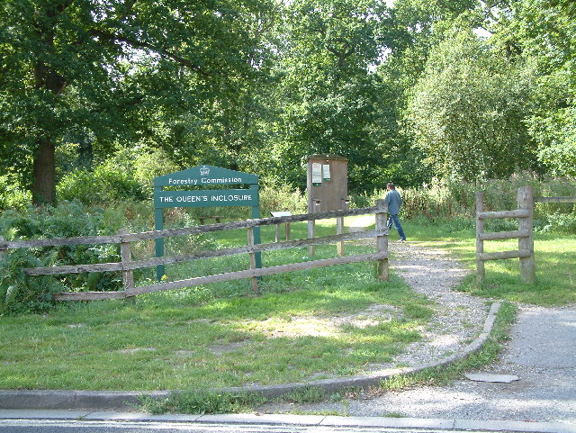
Hursley Forest
✦ Ancient woodland105 ha
Plan your visit
🦉Wildlife🦅Birds🍂Seasonal
Public accessFree entryDogs welcome105 ha
Getting here
51.01541, -1.44056
Open directionsv
Visiting this summer
Seasonal nature notes and what to look for now
- 🌞Midsummer — early morning visits most comfortable; look for deer fawns in quieter clearings
- 🐕Early mornings are best for dog walks in summer — visit before 9am to avoid the heat and find quieter trails
- 🅿️Parking nearby — easy to reach by car
🌤️ Visiting this summer
- 🌞Midsummer — early morning visits most comfortable; look for deer fawns in quieter clearings
- 🐕Early mornings are best for dog walks in summer — visit before 9am to avoid the heat and find quieter trails
- 🅿️Parking nearby — easy to reach by car
- £Free to visit — no entry charge
- 🐕Dogs welcome
- 🌿Ancient woodland — rare wildlife habitat
- 🌳Large woodland — room to roam
🦉Wildlife
Very strong match
Multi-group wildlife — Amphibians, Birds, Mammals, Reptiles; Multi-group wildlife — Amphibians, Birds, Mammals, Reptiles
Free
🦅Bird watching
Very strong match
Birds — Robin, Woodpigeon, Blackbird +54 more · last seen 2026; Birds — Robin, Woodpigeon, Blackbird +54 more · last seen 2026
Free
🍂Seasonal nature
Strong match
Ancient woodland — bluebells, fungi and autumn colour
Free
🦋Insect spotting
Strong match
Insects — Small White, Large White, Meadow Brown +70 more · last seen 2026; Insects — Small White, Large White, Meadow Brown +70 more · last seen 2026
Free
Dogs allowed — public woodland
Free
Deciduous woodland — fungi, berries and wild garlic
Varies
Trails nearby
Within roughly 5 km4 signed routes nearby · 30 public paths nearby
Signed route nearbyPublic paths
Test WayWalking route▾
Named routeListed length 79Regional walking route
Monarch's WayWalking route990 km▾
approximate route of Charles II's escape
Named routeRef MWLength 990 kmRegional walking route
Clarendon WayWalking route▾
Winchester to Salisbury
Named routeRegional walking route
Keble WayWalking route▾
49 signed routes nearby
Signed route nearby
Route 24Cycling route▾
Named routeRef 24National Cycle Network
National BywayCycling route▾
Named routeRef NBRegional cycle route
Route 246Cycling route▾
Named routeRef 246National Cycle Network
EastleighCycling route▾
Named routeLocal cycle route
Route 246Cycling route▾
Named routeRef 246National Cycle Network
Chandlers FordCycling route▾
Named routeLocal cycle route
2 signed routes nearby
Signed route nearby
Farley Mount Off Road Cycle TrailMountain bike route▾
Named routeHampshire off Road cycle trails
Sparsholt Off Road Cycle TrailMountain bike route▾
Named routeHampshire off Road cycle trails
19 public paths nearby
Public paths
Slaxsted Lanebridleway · 562 m▾
Public pathbridlewayLength 562 mPath type: bridleway
Slaxsted Lanebridleway · 243 m▾
Public pathbridlewayLength 243 mPath type: bridleway
Claypit Roadbridleway · 125 m▾
Public pathbridlewayLength 125 mSurface gravelPath type: bridleway
Claypit Roadbridleway · 692 m▾
Public pathbridlewayLength 692 mSurface gravelPath type: track
Claypit Roadbridleway · 130 m▾
Public pathbridlewayLength 130 mSurface gravelIncline 3%Path type: track
Weather for this location
Next 14 daysNearby places
Useful places within 5 km
Own or manage this place?
Claim this listing to keep details accurate, add photos, and highlight what makes it special — free.
Claim this page→How useful was the information on this page?
id: 89f6bd6c-f2e3-4e3a-b8c2-2d25bcbed811
Wildlife to spot
28,175 records · National Biodiversity Network
Wildlife to spot
28,175 records · National Biodiversity Network🐦Birds43 species
autumnwinter
2026▾
Robin · Chaffinch · Blue Tit · Woodpigeon · Blackbird +38
- RobinErithacus rubecula
- ChaffinchFringilla coelebs
- Blue TitCyanistes caeruleus
- WoodpigeonColumba palumbus
- BlackbirdTurdus merula
- DunnockPrunella modularis
- JayGarrulus glandarius
- WrenTroglodytes troglodytes
- Great TitParus major
- GoldfinchCarduelis carduelis
- GoldcrestRegulus regulus2025
- MagpiePica pica
- Long-tailed TitAegithalos caudatus
- NuthatchSitta europaea
- JackdawColoeus monedula2025
- Carrion CrowCorvus corone2025
- GreenfinchChloris chloris2025
- BullfinchPyrrhula pyrrhula
- RedwingTurdus iliacus
- Coal TitPeriparus ater2025
- Mistle ThrushTurdus viscivorus2025
- SiskinSpinus spinus2025
- Stock DoveColumba oenas2025
- PheasantPhasianus colchicus2025
- RavenCorvus corax2025
- Great Spotted WoodpeckerDendrocopos major2025
- TreecreeperCerthia familiaris2025
- Tawny OwlStrix aluco2025
- Pied WagtailMotacilla alba2025
- Green WoodpeckerPicus viridis2025
- SwallowHirundo rustica2025
- ChiffchaffPhylloscopus collybita2025
- Spotted FlycatcherMuscicapa striata2025
- MoorhenGallinula chloropus
- FieldfareTurdus pilaris2025
- Song ThrushTurdus philomelos2025
- LinnetLinaria cannabina2025
- House MartinDelichon urbicum2025
- Herring GullLarus argentatus2025
- SkylarkAlauda arvensis2025
- Canada GooseBranta canadensis2025
- Corvus corax coraxCorvus corax corax2025
- CrossbillLoxia curvirostra2025
Hazel Dormouse · Grey Squirrel · Roe Deer · Brown Hare · Fallow Deer +1
- Hazel DormouseMuscardinus avellanarius
- Grey SquirrelSciurus carolinensis
- Roe DeerCapreolus capreolus
- Brown HareLepus europaeus
- Fallow DeerDama dama
- MoleTalpa europaea
🦎Reptiles2 species
winterspringsummerautumn
2026▾
Slow-worm · Common Lizard
- Slow-wormAnguis fragilis
- Common LizardZootoca vivipara2025
🐸Amphibians1 species
winter
2026▾
Common Frog
- Common FrogRana temporaria
Golden-ringed Dragonfly · Beautiful Demoiselle · Southern Hawker · Migrant Hawker · Banded Demoiselle +10
- Golden-ringed DragonflyCordulegaster boltonii2025
- Beautiful DemoiselleCalopteryx virgo2025
- Southern HawkerAeshna cyanea2025
- Migrant HawkerAeshna mixta2025
- Banded DemoiselleCalopteryx splendens2025
- Emperor Dragonfly
Species observations from the last 10 years via NBN Atlas
Anax imperator2025
Anax imperator2025
HornetVespa crabro2025HornetVespa crabro2025Dark-edged Bee-flyBombylius majorDark-edged Bee-flyBombylius majorDotted Bee-flyBombylius discolorDotted Bee-flyBombylius discolorCramp-Ball Fungus WeevilPlatyrhinus resinosusCramp-Ball Fungus WeevilPlatyrhinus resinosusBlack Oil-beetleMeloe proscarabaeusBlack Oil-beetleMeloe proscarabaeusCommon DarterSympetrum striolatum2025Common DarterSympetrum striolatum2025Myrmus miriformisMyrmus miriformis2025Myrmus miriformisMyrmus miriformis2025Diaperis boletiDiaperis boleti2025Diaperis boletiDiaperis boleti2025Blue-tailed DamselflyIschnura elegans2025Blue-tailed DamselflyIschnura elegans2025Events & activities nearby
Switch provider to compare local events, tours and bookable activities.