Getting here
52.19359, -2.11484
Visiting this summer
Seasonal nature notes and what to look for now
Visiting this summer
Seasonal nature notes and what to look for now
- 🌞Midsummer — early morning visits most comfortable; look for deer fawns in quieter clearings
- 🐕Early mornings are best for dog walks in summer — visit before 9am to avoid the heat and find quieter trails
- 🅿️Parking 389m away — 4 car parks within reach
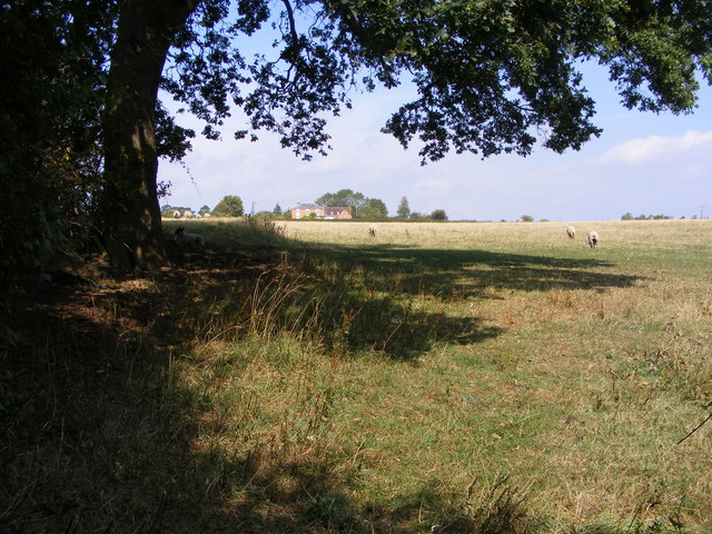
🌤️ Visiting this summer
- 🌞Midsummer — early morning visits most comfortable; look for deer fawns in quieter clearings
- 🐕Early mornings are best for dog walks in summer — visit before 9am to avoid the heat and find quieter trails
- 🅿️Parking 389m away — 4 car parks within reach
Good to know
- £Free to visit — no entry charge
- 🐕Dogs welcome
Best for
Dog walks
Strong match
Dogs allowed — public woodland
Forest walks
Good match
Public woodland
Wildlife
Good match
Native broadleaved woodland
Bird watching
Good match
Native broadleaved woodland — woodland birds
Trails nearby
Within roughly 5 km🚶Walking
5 signed routes nearby · 10 public paths nearby
Signed route nearbyPublic paths
Walking
Millennium Way (Warks)Walking route100 km
A 100 mile long distance footpath, across the centre of England from Pershore to Chipping Warden via Meriden.
Worcester Woods Meadows TrailWalking route
Worcester Woods Woodland TrailWalking route
Wild About Worcester WayWalking route
Wychavon WayWalking route67 km
A route from Holt Fleet on the River Severn to Winchcombe in the Cotswolds.
🚴Cycling
31 signed routes nearby
Signed route nearby
Cycling
Mercian WayCycling route
Kempsey Norton LoopCycling route13.5 km
Crowle - Tibberton Cycle Leisure RouteCycling route12 km
Starting at Worcester Woods Countryside Centre and heading out to Kempsey. A 12 mile route with alternatives to shorten it to 8 miles. The route covers a mixture of quiet lanes and bridleways.
Cotswold Line Cycle RouteCycling route
Local Cycle Route 3Cycling route
A long route curved around the periphery of worcester. Connects with National cycle routes 46 and 45 in both the Northern and Southern ends.
Worcester City Circular Cycle Leisure RouteCycling route9 km
Circular Worcester City route that can be joined at any point and covers a mixture of quiet lanes, towpaths and cycleways.
🐴Horse riding
1 public path nearby
Public paths
Horse riding
No named routes yet. Public paths are shown on the map.
Wildlife to spot
Photos
Weather for this location
Loading local forecast…
Nearby places
Useful places within 5 km
Own or manage this place?
Claim this listing to keep details accurate, add photos, and highlight what makes it special — free.
Claim this pageHow was your visit?
How useful was the information on this page?
id: 447c52ae-05ac-4409-9a4c-2c9544ff4b10