Getting here
52.61298, -1.94604
Visiting this summer
Seasonal nature notes and what to look for now
Visiting this summer
Seasonal nature notes and what to look for now
- 🌞Midsummer — early morning visits most comfortable; look for deer fawns in quieter clearings
- 🐕Early mornings are best for dog walks in summer — visit before 9am to avoid the heat and find quieter trails
- 🅿️Parking 321m away — 6 car parks within reach
🌤️ Visiting this summer
- 🌞Midsummer — early morning visits most comfortable; look for deer fawns in quieter clearings
- 🐕Early mornings are best for dog walks in summer — visit before 9am to avoid the heat and find quieter trails
- 🅿️Parking 321m away — 6 car parks within reach
Good to know
- £Free to visit — no entry charge
- 🐕Dogs welcome
Best for
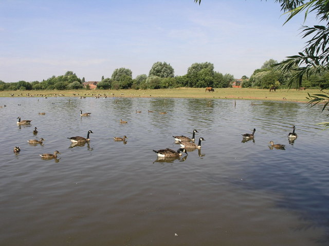
Wildlife
Very strong match
Multi-group wildlife — Amphibians, Birds, Mammals; Multi-group wildlife — Amphibians, Birds, Mammals
Bird watching
Very strong match
Birds — Black-headed Gull, Mallard, Lesser Black-backed Gull +69 more · last seen 2026; Birds — Black-headed Gull, Mallard, Lesser Black-backed Gull +69 more · last seen 2026
Insect spotting
Strong match
Insects — 7-spot Ladybird, 14-spot Ladybird, Swollen-thighed Beetle +94 more · last seen 2025; Insects — 7-spot Ladybird, 14-spot Ladybird, Swollen-thighed Beetle +94 more · last seen 2025
Dog walks
Strong match
Dogs allowed with public access
Foraging
Good match
Deciduous woodland — fungi, berries and wild garlic; Plants — Hazel, Bulrush, Common Nettle +2 more foraging species
Seasonal nature
Good match
Plants — Hazel, Heather, Horse-radish +12 more · last seen 2026; Plants — Hazel, Heather, Horse-radish +12 more · last seen 2026
Trails nearby
Within roughly 5 km🚶Walking
9 signed routes nearby
Signed route nearby
Walking
Monarch's WayWalking route990 km
approximate route of Charles II's escape
Sutton Park Archeology Walk 1: Streetly GateWalking route
Most of Sutton Park is a Scheduled Ancient Monument and contains archaeological remains. This trail, one of six in the park, is via a roman road, medevial deer park, prehistoric mounds, medeval pond, and 16th century wood.
Four Commons WalkWalking route9.5 km
Circular route following the Wyrley & Essington Canal to Clayhanger Common – one of Walsall’s much-loved areas of green, open space. Distance: 6 miles/9.5 km(approx) Duration: 120 mins(approx)
Clayhanger Common WalkWalking route9.5 km
Short, circular route following the Wyrley & Essington Canal to Clayhanger Common – one of Walsall’s much-loved areas of green, open space. Distance: 6 miles/9.5 km(approx) Duration: 120 mins(approx)
Beacon WayWalking route40 km
Starting at Sandwell Valley via the outskirts of Birmingham and the countryside of Walsall into Staffordshire. Take in the Forest of Mercia, lakes, nature reserves, woods, and canal banks. Named after Barr Beacon, one of the highest hills in this area.
🚴Cycling
74 signed routes nearby
Signed route nearby
Cycling
McClean WayCycling route
[PROPOSED]Starley Regional Cycle NetworkCycling route804 km
Starley (TfWM) Regional Cycle Network (Proposed route)
Sneyd Junction to Cannock Extension CanalCycling route8.8 km
A semi-rural route following the curves of the canal, until it opens out into parkland at the Cannock Extension. Distance: 5.5 miles/8.8 km (approx) Duration: 45 min (approx)
Cannock Extension Canal to Longwood JunctionCycling route11.2 km
Canalside route leading past Clayhanger Common and through Rushall, with a pub along the way. Distance: 7 miles/11.2 km (approx) Duration: 60 min (approx)
[PROPOSED]Sandwell Local Cycle NetworkCycling route
Sandwell Local Cycle Network (Proposed)
Walsall Local Cycle NetworkCycling route
Walsall Local Cycle Network
Wildlife to spot
Photos
Weather for this location
Loading local forecast…
Nearby places
Useful places within 5 km
Own or manage this place?
Claim this listing to keep details accurate, add photos, and highlight what makes it special — free.
Claim this pageHow was your visit?
How useful was the information on this page?
id: bb94dfa8-c2c8-4e39-a780-4840df6ac2a2