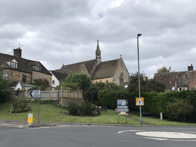
St Bartholomews Church
Getting here
51.70146, -2.36538
Visiting this summer
Seasonal nature notes and what to look for now
Visiting this summer
Seasonal nature notes and what to look for now
- 🐦70+ species recorded in this area — summer evenings are best for activity; watch for Woodpigeon and Magpie
- ☀️Summer family visits work well here — arrive early and plan for a longer stay
- ☕The Froffy Coffee — makes this an easy full-day family visit without needing to pack food
🌤️ Visiting this summer
- 🐦70+ species recorded in this area — summer evenings are best for activity; watch for Woodpigeon and Magpie
- ☀️Summer family visits work well here — arrive early and plan for a longer stay
- ☕The Froffy Coffee — makes this an easy full-day family visit without needing to pack food
Good to know
- £Free to visit — no entry charge
- 🐕Dogs welcome
Best for
Bird watching
Very strong match
Birds — Woodpigeon, Magpie, Meadow Pipit +67 more · last seen 2026; Birds — Woodpigeon, Magpie, Meadow Pipit +67 more · last seen 2026
Wildlife
Strong match
Birds — Woodpigeon, Magpie, Meadow Pipit +67 more · last seen 2026; Birds — Woodpigeon, Magpie, Meadow Pipit +67 more · last seen 2026
Family friendly
Good match
café
Dog walks
Good match
Dogs allowed with public access
Insect spotting
Good match
Insects — Pine Ladybird, Rugged Oil-beetle, Juniper Shieldbug · last seen 2026; Insects — Pine Ladybird, Rugged Oil-beetle, Juniper Shieldbug · last seen 2026
Heritage
Moderate match
Religious grounds — local heritage
Trails nearby
Within roughly 5 km🚶Walking
5 signed routes nearby · 8 public paths nearby
Signed route nearbyPublic paths
Walking
Wotton-under-Edge Cotswold Gateway Route 2Walking route8 km
Cotswold WayWalking route164 km
Cotswold Way (Stinchcombe Hill by pass)Walking route
a short cut across bottom section of Stinchcombe Hill Golf Course
Severn Way (3) Worcester to BristolWalking route153 km
Thames & Severn WayWalking route69.8 km
Linking the Severn to the Thames following the route of the Stroudwater Navigation and Thames & Severn Canal as closely as possible using public rights of way. As the canals are restored, it will be updated to use the reinstated towpath wherever possible.
Old Barn Courtpublic footpath · 38 m
CCA36public footpath · 323 m
🚴Cycling
15 signed routes nearby
Signed route nearby
Cycling
Mercian WayCycling route
Route 41Cycling route
Main RouteCycling route2.7 km
Main RouteCycling route123 m
Main RouteCycling route3.5 km
Main RouteCycling route1.5 km
Wildlife to spot
Photos
Weather for this location
Loading local forecast…
Nearby places
Useful places within 5 km
Own or manage this place?
Claim this listing to keep details accurate, add photos, and highlight what makes it special — free.
Claim this pageHow was your visit?
How useful was the information on this page?
id: de260b78-b648-4684-ad76-191643a5180a