Plan your visit
🦉 Wildlife🦅 Birds🦋 Insects
Public access Free entry Dogs welcome
Places › England › South West › Swindon Getting here
51.61534, -1.78042
Open directionsv Visiting this summer
Seasonal nature notes and what to look for now
▾ 🌞 Midsummer — early morning visits most comfortable; look for deer fawns in quieter clearings 🐕 Early mornings are best for dog walks in summer — visit before 9am to avoid the heat and find quieter trails 🅿️ Parking 168m away — 2 car parks within reach 🌤️ Visiting this summer
🌞 Midsummer — early morning visits most comfortable; look for deer fawns in quieter clearings 🐕 Early mornings are best for dog walks in summer — visit before 9am to avoid the heat and find quieter trails 🅿️ Parking 168m away — 2 car parks within reach £ Free to visit — no entry charge🐕 Dogs welcome🦉 Wildlife
Very strong match
Multi-group wildlife — Birds, Mammals; Multi-group wildlife — Birds, Mammals
Free
🦅 Bird watching
Strong match
Birds — Robin, Woodpigeon, Blackbird +42 more · last seen 2025; Birds — Robin, Woodpigeon, Blackbird +42 more · last seen 2025
Free
🦋 Insect spotting
Strong match
Insects — Meadow Brown, Gatekeeper, Ringlet +60 more · last seen 2025; Insects — Meadow Brown, Gatekeeper, Ringlet +60 more · last seen 2025
Free
🍂 Seasonal nature
Strong match
Plants — Herb-Robert, Maidenhair Spleenwort, Ribwort Plantain +20 more · last seen 2025; Plants — Herb-Robert, Maidenhair Spleenwort, Ribwort Plantain +20 more · last seen 2025
Free
Dogs allowed with public access
Free
Named hiking route nearby: The Roman Way
Free
Trails nearby Within roughly 5 km 4 signed routes nearby · 7 public paths nearby
Signed route nearby Public paths
The Roman Way Walking route 274.5 km ▾
Named route Length 274.5 km Regional walking route
Show on map Millennium Trail Walking route ▾
Named route Local walking route
Show on map Thames Path Walking route 296 km ▾
Named route Ref TP Length 296 km National walking route
Show on map Thames & Severn Way Walking route 69.8 km ▾
Linking the Severn to the Thames following the route of the Stroudwater Navigation and Thames & Severn Canal as closely as possible using public rights of way. As the canals are restored, it will be updated to use the reinstated towpath wherever possible.
Named route Ref T&S W Length 69.8 km Point-to-point Regional walking route
Show on map Chapel Hill public footpath · 133 m ▾
Public path public footpath Length 133 m Surface asphalt Path type: residential
Show on map 19 signed routes nearby
Signed route nearby
Mercian Way Cycling route ▾
Named route Ref 45 National Cycle Network
Show on map Eastern Flyer Cycling route ▾
Named route Ref EF Local cycle route
Show on map Tadpole Round Cycling route 9.1 km ▾
Named route Ref TR Length 9.1 km Round trip Local cycle route
Show on map Haydon Round Cycling route 11.8 km ▾
Named route Ref HR Length 11.8 km Round trip Local cycle route
Show on map West Swindon Round Cycling route 11.3 km ▾
Named route Ref WSR Length 11.3 km Round trip Local cycle route
Show on map Urban Round Cycling route 27 km ▾
Named route Ref UR Length 27 km Round trip Local cycle route
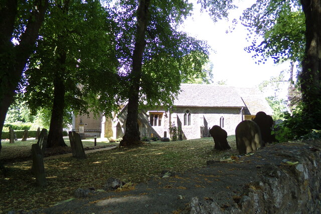
Show on map Photos St. Leonard's Church, Blunsdon
‹ ›
Weather for this location Next 14 days Nearby places Useful places within 5 km
Own or manage this place?
Claim this listing to keep details accurate, add photos, and highlight what makes it special — free.
Claim this page→ How useful was the information on this page?
id: b7cf23c0-759e-4829-a88d-a997b10a06dd
UK green spaces mapped from open public data — so anyone can find the woodland, trail, or nature reserve closest to them.
© 2026 Glade · Made with care for UK green spaces
Events & activities nearby Switch provider to compare local events, tours and bookable activities.
Bookable tours GetYourGuide Promote here
Wildlife to spot
7,905 records · National Biodiversity Network
▾
Wildlife to spot 7,905 records · National Biodiversity Network 🐦 Birds 32 species
winter spring
2025 ▾
Robin · Woodpigeon · Great Tit · Blackbird · House Sparrow +27
Robin Erithacus rubecula Woodpigeon Columba palumbus Great Tit Parus major Blackbird Turdus merula House Sparrow Passer domesticus Blue Tit Cyanistes caeruleus Goldfinch Carduelis carduelis Greenfinch Chloris chloris Wren Troglodytes troglodytes Jackdaw Coloeus monedula Blackcap Sylvia atricapilla Chiffchaff Phylloscopus collybita Song Thrush Turdus philomelos Magpie Pica pica Kestrel Falco tinnunculus Grey Wagtail Motacilla cinerea Skylark Alauda arvensis Coal Tit Periparus ater Pied Wagtail Motacilla alba Starling Sturnus vulgaris Jay Garrulus glandarius Collared Dove Streptopelia decaocto Linnet Linaria cannabina Pheasant Phasianus colchicus Dunnock Prunella modularis Red-legged Partridge Alectoris rufa Chaffinch Fringilla coelebs Great Spotted Woodpecker Dendrocopos major Nuthatch Sitta europaea Fieldfare Turdus pilaris Redwing Turdus iliacus Carrion Crow Corvus corone Noctule · Common Pipistrelle · Red Fox · Roe Deer · Hedgehog
Noctule Nyctalus noctula2024 Common Pipistrelle Pipistrellus pipistrellus2024 Red Fox Vulpes vulpes Roe Deer Capreolus capreolus Hedgehog Erinaceus europaeus Meadow Brown · Small White · Speckled Wood · Gatekeeper · Large White +16
Meadow Brown Maniola jurtina2024 Small White Pieris rapae2024 Speckled Wood Pararge aegeria2024 Gatekeeper Pyronia tithonus2024 Large White Pieris brassicae2024 Small Skipper Thymelicus sylvestris Field Madder · Blackthorn · Wild Marjoram · Ribwort Plantain · Lesser Trefoil +3
Field Madder Sherardia arvensis Blackthorn Prunus spinosa Wild Marjoram Origanum vulgare Ribwort Plantain Plantago lanceolata Lesser Trefoil Trifolium dubium Herb-Robert Geranium robertianum Maidenhair Spleenwort Asplenium trichomanes Species observations from the last 10 years via NBN Atlas
2024
2024
Ringlet Aphantopus hyperantus2024
Ringlet Aphantopus hyperantus2024
Brimstone Gonepteryx rhamni2024
Brimstone Gonepteryx rhamni2024
Common Blue Polyommatus icarus2024
Common Blue Polyommatus icarus2024
Emperor Dragonfly Anax imperator
Emperor Dragonfly Anax imperator
Green-veined White Pieris napi2024
Green-veined White Pieris napi2024
Migrant Hawker Aeshna mixta
Migrant Hawker Aeshna mixta
Common Darter Sympetrum striolatum
Common Darter Sympetrum striolatum
Brown Hawker Aeshna grandis
Brown Hawker Aeshna grandis
7-spot Ladybird Coccinella septempunctata
7-spot Ladybird Coccinella septempunctata
Eristalis pertinax Eristalis pertinax2024
Eristalis pertinax Eristalis pertinax2024
Scathophaga stercoraria Scathophaga stercoraria2024
Scathophaga stercoraria Scathophaga stercoraria2024
Eristalis tenax Eristalis tenax2024
Eristalis tenax Eristalis tenax2024
Comma Polygonia c-album2024
Comma Polygonia c-album2024
Red Admiral Vanessa atalanta2024
Red Admiral Vanessa atalanta2024
Peacock Aglais io2024
Peacock Aglais io2024
Water Mint Mentha aquatica2024
Water Mint Mentha aquatica2024