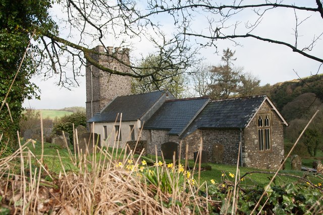
St Mary's Church
Plan your visit
Getting here
51.21237, -3.71642
Visiting this summer
Seasonal nature notes and what to look for now
Visiting this summer
Seasonal nature notes and what to look for now
- 🐦69+ species recorded in this area — summer evenings are best for activity; watch for Chaffinch and Robin
- ✦Historic character is a year-round quality here — summer brings its own atmosphere to the setting
- ☕Lorna Doone Farm Cafe & B&B — makes this an easy full-day family visit without needing to pack food
🌤️ Visiting this summer
- 🐦69+ species recorded in this area — summer evenings are best for activity; watch for Chaffinch and Robin
- ✦Historic character is a year-round quality here — summer brings its own atmosphere to the setting
- ☕Lorna Doone Farm Cafe & B&B — makes this an easy full-day family visit without needing to pack food
Good to know
- £Free to visit — no entry charge
- 🐕Dogs welcome
Best for
Bird watching
Very strong match
Birds — Chaffinch, Robin, Carrion Crow +66 more · last seen 2025
Wildlife
Strong match
Birds — Chaffinch, Robin, Carrion Crow +66 more · last seen 2025
Insect spotting
Strong match
Insects — Meadow Brown, Gatekeeper, Ringlet +34 more · last seen 2025
Heritage
Strong match
Grade II* listed building: CHURCH OF ST MARY; Religious grounds — local heritage
Dog walks
Good match
Dogs allowed with public access
Churchyard walks
Good match
Churchyard or religious grounds — wildlife sanctuary and quiet reflection
Trails nearby
Within roughly 5 km🚶Walking
5 signed routes nearby · 6 public paths nearby
Signed route nearbyPublic paths
Walking
Watersmeet to Ash Bridge circular walkWalking route3.5 km
South West Coast Path (Section 2: Porlock Weir to Lynmouth / Lynton)Walking route
Coleridge WayWalking route82 km
King Charles III England Coast Path: Minehead to Combe MartinWalking route
Macmillan Way WestWalking route
🚴Cycling
8 signed routes nearby
Signed route nearby
Cycling
Regional Route 51Cycling route
NCN 3 to NCN 51 LinkCycling route
N/ACycling route10.7 km
N/ACycling route1.4 km
N/ACycling route131 m
N/ACycling route2.1 km
🐴Horse riding
4 public paths nearby
Public paths
Horse riding
No named routes yet. Public paths are shown on the map.
Wildlife to spot
Photos
Weather for this location
Loading local forecast…
Nearby places
Useful places within 5 km