Getting here
51.64404, -1.27621
About SUTTON COURTENAY MANOR
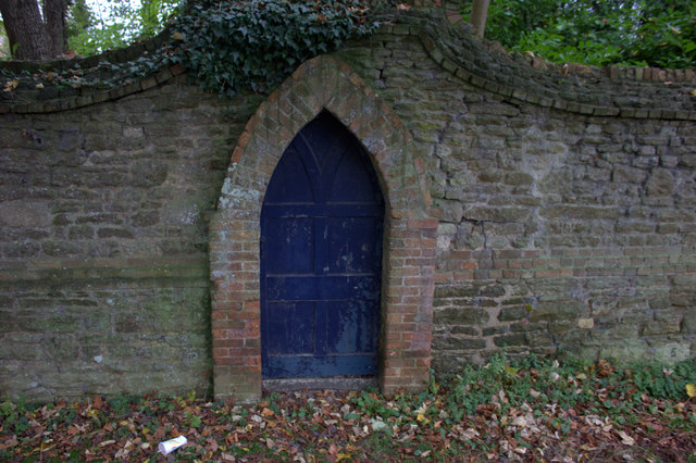
The Manor House, Sutton Courtenay, is a Grade II* listed building in the Oxfordshire village, located southwest of the village green and hidden from the main road by trees. It is across the street from The Abbey, Sutton Courtenay, a medieval courtyard house.
Read more on Wikipedia →Visiting this summer
Seasonal nature notes and what to look for now
Visiting this summer
Seasonal nature notes and what to look for now
- 🌞Midsummer — early morning visits most comfortable; look for deer fawns in quieter clearings
- ✦Historic character is a year-round quality here — summer brings its own atmosphere to the setting
- 🐕Dogs welcome — bring water in summer; the site has enough space to find shade on hot days
🌤️ Visiting this summer
- 🌞Midsummer — early morning visits most comfortable; look for deer fawns in quieter clearings
- ✦Historic character is a year-round quality here — summer brings its own atmosphere to the setting
- 🐕Dogs welcome — bring water in summer; the site has enough space to find shade on hot days
Good to know
- 🐕Dogs welcome
Best for
Bird watching
Strong match
Grazing marsh — lapwing, redshank, snipe and wintering wildfowl
Wildlife
Strong match
Deciduous woodland priority habitat
Heritage
Strong match
Historic site
Waterside walks
Good match
Grazing marsh and ditches — waterside walking
Foraging
Good match
Deciduous woodland — fungi, berries and wild garlic
Trails nearby
Within roughly 5 km🚶Walking
8 signed routes nearby · 48 public paths nearby
Signed route nearbyPublic paths
Walking
Oxford Green Belt WayWalking route87 km
The Vale WayWalking route43 km
Route through the Vale of White Horse in Oxfordshire, UK. (27 miles).
European walking route E2 west, UK, South East EnglandWalking route
Westroute: Stranraer (UK) - Birminhgham (UK) - Calais (FR) - Zoersel (BE) / Eastroute: Stranraer (UK) - Harwich (UK) - Rotterdam (NL) - Zoersel (BE) / Both Routes: Zoersel (BE) - Maastrich (NL) - Luxembourg (LUX) - Lake Geneva (CH) - Nice (FR)
Marcham Jubilee WalksWalking route
Ock Valley River WalkWalking route
Churchmere Roadpublic footpath · 91 m
Churchmere Roadpublic footpath · 75 m
Ginge Brookpublic footpath · 161 m
🚴Cycling
95 signed routes nearby
Signed route nearby
Cycling
National Cycle Network Route 5Cycling route
Route 544Cycling route
Didcot to Culham Science CentreCycling route
Didcot to Milton ParkCycling route
Didcot to Harwell CampusCycling route
Abingdon to Milton ParkCycling route
🐴Horse riding
12 public paths nearby
Public paths
Horse riding
All Saints Lanebridleway · 255 m
All Saints Lanebridleway · 117 m
Old Wallingford Waybyway open to all traffic · 103 m
All Saints Lanebridleway · 74 m
Old Wallingford Waybyway open to all traffic · 62 m
Wildlife to spot
Photos
Weather for this location
Loading local forecast…
Nearby places
Useful places within 5 km
Own or manage this place?
Claim this listing to keep details accurate, add photos, and highlight what makes it special — free.
Claim this pageHow was your visit?
How useful was the information on this page?
id: fe130179-a3bf-48dd-97b2-f64fb9f58635