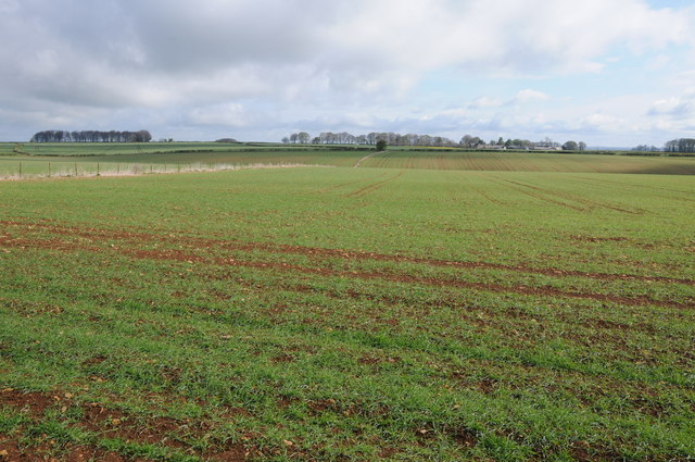
The Chessalls Roman town 60 ha
Plan your visit
🦉 Wildlife🦅 Birds🌿 Foraging
Free entry Dogs welcome 60 ha
Places › England › South West › Cotswold Getting here
51.66159, -2.28072
Open directionsv ✦ Scheduled Ancient Monument — Nationally protected archaeological site on the National Heritage List for England (NHLE). Scheduled monuments represent the best surviving examples of England's irreplaceable archaeological heritage.
Archaeological site scheduled monument
Visiting this summer
Seasonal nature notes and what to look for now
▾ ☀️ June — long evenings and clear skies; one of the most rewarding months for a late visit 🌿 Foraging is at its best in summer here 🐕 Dogs welcome — bring water in summer; the site has enough space to find shade on hot days 🌤️ Visiting this summer
☀️ June — long evenings and clear skies; one of the most rewarding months for a late visit 🌿 Foraging is at its best in summer here 🐕 Dogs welcome — bring water in summer; the site has enough space to find shade on hot days £ Free to visit — no entry charge🐕 Dogs welcome🦉 Wildlife
Very strong match
Multi-group wildlife — Birds, Mammals, Reptiles; Multi-group wildlife — Birds, Mammals, Reptiles
Free
🦅 Bird watching
Very strong match
Birds — Tawny Owl, Pheasant, Woodpigeon +63 more · last seen 2025; Birds — Tawny Owl, Pheasant, Woodpigeon +63 more · last seen 2025
Free
Plants — Bramble, Common Nettle, Hawthorn +13 more foraging species; Deciduous woodland — fungi, berries and wild garlic
Varies
🍂 Seasonal nature
Strong match
Plants — Crested Dog's-tail, Cock's-foot, Timothy +124 more · last seen 2017; Plants — Crested Dog's-tail, Cock's-foot, Timothy +124 more · last seen 2017
Free
🦋 Insect spotting
Strong match
Insects — Small White, Large White, Meadow Brown +32 more · last seen 2024; Insects — Small White, Large White, Meadow Brown +32 more · last seen 2024
Free
Trails nearby Within roughly 5 km 8 signed routes nearby · 15 public paths nearby
Signed route nearby Public paths
Monarch's Way Walking route 990 km ▾
approximate route of Charles II's escape
Named route Ref MW Length 990 km Regional walking route
Show on map Newark Park Pink Trail Walking route ▾
Named route Round trip Local walking route
Show on map Newark Park Purple Trail Walking route ▾
Named route Round trip Local walking route
Show on map Wotton-under-Edge Cotswold Gateway Route 2 Walking route 8 km ▾
Named route Ref WGR2 Length 8 km Round trip Local walking route
Show on map Cotswold Way Walking route 164 km ▾
Named route Ref CW Length 164 km National walking route
Show on map 11 signed routes nearby
Signed route nearby
Mercian Way Cycling route ▾
Named route Ref 45 National Cycle Network
Show on map Main Route Cycling route 145 m ▾
Named route Ref 45 Length 145 m National Cycle Network Traffic-free Surface asphalt
Show on map Main Route Cycling route 85 m ▾
Named route Ref 45 Length 85 m National Cycle Network On-road Surface asphalt
Show on map Main Route Cycling route 184 m ▾
Named route Ref 45 Length 184 m National Cycle Network Traffic-free Surface unsealedfirm
Show on map Main Route Cycling route 554 m ▾
Named route Ref 45 Length 554 m National Cycle Network Traffic-free Surface unsealedfirm
Show on map Main Route Cycling route 42 m ▾
Named route Ref 45 Length 42 m National Cycle Network On-road Surface asphalt
Show on map 3 public paths nearby
Public paths
No named routes yet. Public paths are shown on the map.
Weather for this location Next 14 days Nearby places Useful places within 5 km
All Historic
How useful was the information on this page?
id: f1bfce8c-3c96-4620-92a7-5d6190f0fafd
UK green spaces mapped from open public data — so anyone can find the woodland, trail, or nature reserve closest to them.
© 2026 Glade · Made with care for UK green spaces
Wildlife to spot
5,488 records · National Biodiversity Network
▾
Wildlife to spot 5,488 records · National Biodiversity Network 🐦 Birds 41 species
winter autumn
2025 ▾
Kestrel · Woodpigeon · Pheasant · Blue Tit · Carrion Crow +36
Kestrel Falco tinnunculus Woodpigeon Columba palumbus Pheasant Phasianus colchicus Blue Tit Cyanistes caeruleus Carrion Crow Corvus corone Jackdaw Coloeus monedula Great Tit Parus major Red-legged Partridge Alectoris rufa Wren Troglodytes troglodytes Chaffinch Fringilla coelebs Blackbird Turdus merula Robin Erithacus rubecula Rook Corvus frugilegus Linnet Linaria cannabina Stock Dove Columba oenas Raven Corvus corax Marsh Tit Poecile palustris Long-tailed Tit Aegithalos caudatus Song Thrush Turdus philomelos Skylark Alauda arvensis Dunnock Prunella modularis Barn Owl Tyto alba Great Spotted Woodpecker Dendrocopos major Common Gull Larus canus Green Woodpecker Picus viridis Swallow Hirundo rustica Fieldfare Turdus pilaris Blackcap Sylvia atricapilla Starling Sturnus vulgaris Magpie Pica pica Greenfinch Chloris chloris Goldcrest Regulus regulus Mallard Anas platyrhynchos2024 Coal Tit Periparus ater2024 Nuthatch Sitta europaea2024 Meadow Pipit Anthus pratensis2024 Redwing Turdus iliacus2024 Yellowhammer Emberiza citrinella2024 Pied Wagtail Motacilla alba yarrellii2024 Grey Heron Ardea cinerea2024 Jay Garrulus glandarius2024 Large White · Small White · Meadow Brown · Green-veined White · Gatekeeper +7
Large White Pieris brassicae Small White Pieris rapae Meadow Brown Maniola jurtina Green-veined White Pieris napi Gatekeeper Pyronia tithonus Marbled White Melanargia galathea Brown Argus Aricia agestis 🌿 Plants 52 species
spring summer
2024 ▾
Hoary Plantain · Wall Whitlowgrass · Common Sorrel · Meadow Crane's-bill · Beaked Hawk's-beard +47
Hoary Plantain Plantago media Wall Whitlowgrass Drabella muralis Common Sorrel Rumex acetosa Meadow Crane's-bill Geranium pratense Beaked Hawk's-beard Crepis vesicaria daffodils Narcissus Species observations from the last 10 years via NBN Atlas
Common Blue Polyommatus icarus
Common Blue Polyommatus icarus
Speckled Wood Pararge aegeria
Speckled Wood Pararge aegeria
Small Copper Lycaena phlaeas
Small Copper Lycaena phlaeas
Red Admiral Vanessa atalanta
Red Admiral Vanessa atalanta
Peacock Aglais io
Peacock Aglais io Pineappleweed
Pineappleweed
Matricaria discoidea
Matricaria discoidea
Shining Crane's-bill Geranium lucidum
Shining Crane's-bill Geranium lucidum
Common Bird's-foot-trefoil Lotus corniculatus
Common Bird's-foot-trefoil Lotus corniculatus
Ramsons Allium ursinum
Ramsons Allium ursinum
Tutsan Hypericum androsaemum
Tutsan Hypericum androsaemum
Welted Thistle Carduus crispus
Welted Thistle Carduus crispus
Common Restharrow Ononis repens
Common Restharrow Ononis repens
Long-headed Poppy Papaver dubium
Long-headed Poppy Papaver dubium
Field Forget-me-not Myosotis arvensis
Field Forget-me-not Myosotis arvensis
Upright Brome Bromopsis erecta
Upright Brome Bromopsis erecta
Hairy Bitter-cress Cardamine hirsuta
Hairy Bitter-cress Cardamine hirsuta
Field Pansy Viola arvensis
Field Pansy Viola arvensis
Cowslip Primula veris
Cowslip Primula veris
Dogwood Cornus sanguinea
Dogwood Cornus sanguinea
Mouse-ear-hawkweed Pilosella officinarum
Mouse-ear-hawkweed Pilosella officinarum
Bulbous Buttercup Ranunculus bulbosus
Bulbous Buttercup Ranunculus bulbosus
Quaking-grass Briza media
Quaking-grass Briza media
Oxeye Daisy Leucanthemum vulgare
Oxeye Daisy Leucanthemum vulgare
Sticky Mouse-ear Cerastium glomeratum
Sticky Mouse-ear Cerastium glomeratum
Meadow Buttercup Ranunculus acris
Meadow Buttercup Ranunculus acris
Cow Parsley Anthriscus sylvestris
Cow Parsley Anthriscus sylvestris
Thyme-leaved Speedwell Veronica serpyllifolia
Thyme-leaved Speedwell Veronica serpyllifolia
Common Vetch Vicia sativa
Common Vetch Vicia sativa
Perforate St John's-wort Hypericum perforatum
Perforate St John's-wort Hypericum perforatum
Wild Marjoram Origanum vulgare
Wild Marjoram Origanum vulgare
Winter-cress Barbarea vulgaris
Winter-cress Barbarea vulgaris
Cat's-ear Hypochaeris radicata
Cat's-ear Hypochaeris radicata
Glaucous Sedge Carex flacca
Glaucous Sedge Carex flacca
Male-fern Dryopteris filix-mas
Male-fern Dryopteris filix-mas
Red Dead-nettle Lamium purpureum
Red Dead-nettle Lamium purpureum
Field Wood-rush Luzula campestris
Field Wood-rush Luzula campestris
Greater Stitchwort Stellaria holostea
Greater Stitchwort Stellaria holostea
Hogweed Heracleum sphondylium
Hogweed Heracleum sphondylium
Wood Anemone Anemone nemorosa
Wood Anemone Anemone nemorosa
Wood Millet Milium effusum
Wood Millet Milium effusum
Goldilocks Buttercup Ranunculus auricomus
Goldilocks Buttercup Ranunculus auricomus
Lesser Celandine Ficaria verna
Lesser Celandine Ficaria verna
Mistletoe Viscum album
Mistletoe Viscum album
Yew Taxus baccata
Yew Taxus baccata
Ivy-leaved Speedwell Veronica hederifolia
Ivy-leaved Speedwell Veronica hederifolia
Common Ragwort Jacobaea vulgaris
Common Ragwort Jacobaea vulgaris
Purple Toadflax Linaria purpurea
Purple Toadflax Linaria purpurea
Pedunculate Oak Quercus robur
Pedunculate Oak Quercus robur
Daisy Bellis perennis
Daisy Bellis perennis
Snowdrop Galanthus nivalis
Snowdrop Galanthus nivalis
Stinking Iris Iris foetidissima
Stinking Iris Iris foetidissima Events & activities nearby Switch provider to compare local events, tours and bookable activities.
Bookable tours