Plan your visit
🦉 Wildlife🦅 Birds⚽ Pitches
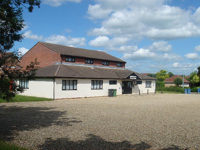
Public access Dogs welcome
Places › England › Eastern › Babergh Getting here
51.99233, 0.83501
Open directionsv Visiting this summer
Seasonal nature notes and what to look for now
▾ 🌞 Midsummer — early morning visits most comfortable; look for deer fawns in quieter clearings ⚽ Playing fields is at its best in summer here 🐕 Dogs welcome — bring water in summer; the site has enough space to find shade on hot days 🌤️ Visiting this summer
🌞 Midsummer — early morning visits most comfortable; look for deer fawns in quieter clearings ⚽ Playing fields is at its best in summer here 🐕 Dogs welcome — bring water in summer; the site has enough space to find shade on hot days 🦉 Wildlife
Very strong match
Multi-group wildlife — Amphibians, Birds, Mammals, Reptiles; Multi-group wildlife — Amphibians, Birds, Mammals, Reptiles
Free
🦅 Bird watching
Very strong match
Birds — Blue Tit, Robin, Chiffchaff +62 more · last seen 2025; Birds — Blue Tit, Robin, Chiffchaff +62 more · last seen 2025
Free
⚽ Playing fields
Very strong match
Playing field
Free
🍂 Seasonal nature
Strong match
Plants — Wood Anemone, Hedge Woundwort, Goat Willow +62 more · last seen 2026; Plants — Wood Anemone, Hedge Woundwort, Goat Willow +62 more · last seen 2026
Free
Plants — Wood-sorrel, Nettle-leaved Bellflower, Hazel +8 more foraging species
Varies
🦋 Insect spotting
Strong match
Insects — Stag Beetle, Mecinus pascuorum, Larch Ladybird +21 more · last seen 2025; Insects — Stag Beetle, Mecinus pascuorum, Larch Ladybird +21 more · last seen 2025
Free
Trails nearby Within roughly 5 km 3 signed routes nearby · 7 public paths nearby
Signed route nearby Public paths
St Edmund Way Walking route ▾
Named route Listed length 142km Regional walking route
Show on map Stour Valley Path part 2 Walking route ▾
Named route Regional walking route
Show on map Essex Way (Epping to Stratford St Mary) Walking route ▾
Named route Regional walking route
Show on map 16 signed routes nearby
Signed route nearby
South Suffolk Cycle Route A2 (Bures Loop) Cycling route ▾
Named route Ref A2 Regional cycle route
Show on map South Suffolk Cycle Route A3 (Boxford Link) Cycling route ▾
Named route Ref A3 Regional cycle route
Show on map Route 13 Cycling route ▾
Named route Ref 13 National Cycle Network
Show on map Wolf Way Cycling route 400 km ▾
Named route Ref Wolf Way Length 400 km Round trip Local cycle route
Show on map Main Route Cycling route 144 m ▾
Named route Ref 13 Length 144 m National Cycle Network On-road Surface asphalt
Show on map Main Route Cycling route 17 m ▾
Named route Ref 13 Length 17 m National Cycle Network On-road Surface asphalt
Show on map 4 public paths nearby
Public paths
Kingsland Lane byway open to all traffic · 129 m ▾
Public path byway open to all traffic Length 129 m Path type: residential
Show on map Kingsland Lane byway open to all traffic · 877 m ▾
Public path byway open to all traffic Length 877 m Path type: bridleway
Show on map
Weather for this location Next 14 days Nearby places Useful places within 5 km
All Historic
Own or manage this place?
Claim this listing to keep details accurate, add photos, and highlight what makes it special — free.
Claim this page→ How useful was the information on this page?
id: 60e1cf54-23fd-4722-9f92-0e9170855a80
UK green spaces mapped from open public data — so anyone can find the woodland, trail, or nature reserve closest to them.
© 2026 Glade · Made with care for UK green spaces
Wildlife to spot
10,233 records · National Biodiversity Network
▾
Wildlife to spot 10,233 records · National Biodiversity Network Blue Tit · Blackbird · Long-tailed Tit · Great Tit · Robin +44
Blue Tit Cyanistes caeruleus Blackbird Turdus merula Long-tailed Tit Aegithalos caudatus Great Tit Parus major Robin Erithacus rubecula Woodpigeon Columba palumbus Wren Troglodytes troglodytes Chiffchaff Phylloscopus collybita Jackdaw Coloeus monedula Blackcap Sylvia atricapilla Green Woodpecker Picus viridis Song Thrush Turdus philomelos Raven Corvus corax Skylark Alauda arvensis Nuthatch Sitta europaea Great Spotted Woodpecker Dendrocopos major Jay Garrulus glandarius Treecreeper Certhia familiaris Goldcrest Regulus regulus Coal Tit Periparus ater Dunnock Prunella modularis Peregrine Falco peregrinus Marsh Tit Poecile palustris Nightingale Luscinia megarhynchos Carrion Crow Corvus corone Linnet Linaria cannabina Garden Warbler Sylvia borin Reed Bunting Emberiza schoeniclus Whitethroat Curruca communis Kestrel Falco tinnunculus Bullfinch Pyrrhula pyrrhula Greenfinch Chloris chloris Stock Dove Columba oenas Merlin Falco columbarius Chaffinch Fringilla coelebs Redwing Turdus iliacus Hobby Falco subbuteo Yellowhammer Emberiza citrinella Moorhen Gallinula chloropus Swallow Hirundo rustica Goldfinch Carduelis carduelis Red-legged Partridge Alectoris rufa Magpie Pica pica Mistle Thrush Turdus viscivorus Pheasant Phasianus colchicus Rook Corvus frugilegus Barn Owl Tyto alba2024 Lesser Redpoll Acanthis flammea cabaret2024 Fieldfare Turdus pilaris2024 🦌 Mammals 2 species
spring winter
2025 ▾
Grey Squirrel · Muntjac
Grey Squirrel Sciurus carolinensis Muntjac Muntiacus reevesi 🐸 Amphibians 1 species
spring
2025 ▾
Common Toad
🐝 Insects 7 species
spring summer
2025 ▾
Common Blue Damselfly · 7-spot Ladybird · Migrant Hawker · Glow-worm · Phaonia valida +2
Common Blue Damselfly Enallagma cyathigerum 7-spot Ladybird Coccinella septempunctata Migrant Hawker Aeshna mixta Glow-worm Lampyris noctiluca Phaonia valida Phaonia valida Dark-edged Bee-fly Bombylius major Wood Anemone · Goat Willow · Dog's Mercury · Wood-sorrel · Wood Spurge +23
Wood Anemone Anemone nemorosa Goat Willow Salix caprea Dog's Mercury Mercurialis perennis Wood-sorrel Oxalis acetosella2025 Wood Spurge Euphorbia amygdaloides2025 Greater Periwinkle Vinca major Alternate-leaved Golden-saxifrage Species observations from the last 10 years via NBN Atlas
Orange Ladybird
Orange Ladybird
Halyzia sedecimguttata
Halyzia sedecimguttata
Chrysosplenium alternifolium
Chrysosplenium alternifolium
Bluebell Hyacinthoides non-scripta
Bluebell Hyacinthoides non-scripta
Early Dog-violet Viola reichenbachiana
Early Dog-violet Viola reichenbachiana
Great Horsetail Equisetum telmateia2025
Great Horsetail Equisetum telmateia2025
Quince Cydonia oblonga2025
Quince Cydonia oblonga2025
Common Ragwort Jacobaea vulgaris2025
Common Ragwort Jacobaea vulgaris2025
Water Avens Geum rivale2025
Water Avens Geum rivale2025
Primrose Primula vulgaris2025
Primrose Primula vulgaris2025
Polypody Polypodium vulgare2025
Polypody Polypodium vulgare2025
Common Nettle Urtica dioica2025
Common Nettle Urtica dioica2025
Hawthorn Crataegus monogyna2025
Hawthorn Crataegus monogyna2025
Wild Cherry Prunus avium2025
Wild Cherry Prunus avium2025
Hazel Corylus avellana2025
Hazel Corylus avellana2025
Wild Strawberry Fragaria vesca2025
Wild Strawberry Fragaria vesca2025
Holly Ilex aquifolium2025
Holly Ilex aquifolium2025
Lords-and-Ladies Arum maculatum2025
Lords-and-Ladies Arum maculatum2025
Ramsons Allium ursinum2025
Ramsons Allium ursinum2025
Ivy Hedera helix2025
Ivy Hedera helix2025
Sweet Violet Viola odorata2025
Sweet Violet Viola odorata2025
Lesser Celandine Ficaria verna2025
Lesser Celandine Ficaria verna2025
Ground-ivy Glechoma hederacea2025
Ground-ivy Glechoma hederacea2025
Cowslip Primula veris2025
Cowslip Primula veris2025 Events & activities nearby Switch provider to compare local events, tours and bookable activities.
Bookable tours GetYourGuide Promote here