Tudor Grange Park
Getting here
52.41055, -1.78788
Visiting this summer
Seasonal nature notes and what to look for now
Visiting this summer
Seasonal nature notes and what to look for now
- 🌞Midsummer — early morning visits most comfortable; look for deer fawns in quieter clearings
- 🧺Good picnic destination in summer — open space and facilities for a relaxed day out
- 🛝Playground on site — built-in entertainment for younger visitors alongside the wider site
🌤️ Visiting this summer
- 🌞Midsummer — early morning visits most comfortable; look for deer fawns in quieter clearings
- 🧺Good picnic destination in summer — open space and facilities for a relaxed day out
- 🛝Playground on site — built-in entertainment for younger visitors alongside the wider site
Good to know
- £Free to visit — no entry charge
- 🐕Dogs welcome
Best for
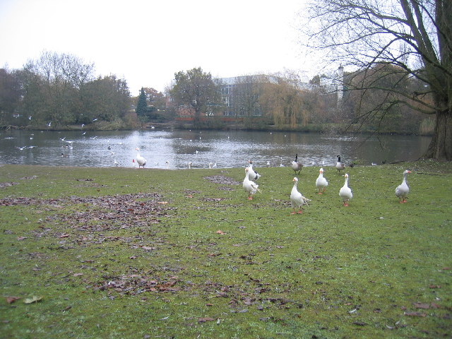
Wildlife
Very strong match
Multi-group wildlife — Amphibians, Birds, Mammals; Multi-group wildlife — Amphibians, Birds, Mammals
Bird watching
Very strong match
Birds — Wigeon, Stock Dove, House Sparrow +61 more · last seen 2026; Birds — Wigeon, Stock Dove, House Sparrow +61 more · last seen 2026
Picnic day out
Strong match
picnic area, car park; Urban park — open green space
Family friendly
Strong match
playground, picnic area; Urban park — family destination
Playgrounds
Strong match
playground, parking
Dog walks
Strong match
Dogs allowed with public access
Trails nearby
Within roughly 5 km🚶Walking
16 signed routes nearby
Signed route nearby
Walking
Grand Union Canal WalkWalking route234 km
Birmingham to Napton section
Millennium Way (Warks)Walking route100 km
A 100 mile long distance footpath, across the centre of England from Pershore to Chipping Warden via Meriden.
Rail Trail: Widney Manor > DorridgeWalking route4.4 km
A 2.75-mile easy walk through Solihull’s suburbia and countryside between two stations, crossing the M42 and the river Blythe. Duration: 1.5 hours Distance: 2.75 miles
Rail Trail: Birmingham International > Marston GreenWalking route6.4 km
A 4-mile walk discovering wildflower meadows, oak woodland and parkland along Low Brook on an easy route to Marston Green. Plane spotting optional! Duration: 1.5 hours Distance: 4 miles
Rail Trail: Olton > ShirleyWalking route12.5 km
An 8-mile longer meander along the banks of the Grand Union Canal and the River Cole, through the heart of Tolkein Country! Duration: 3.5 hours Distance: 8 miles
🚴Cycling
4 signed routes nearby
Signed route nearby
Cycling
Solihull-KnowleCycling route
Cole Valley RouteCycling route
Billesley & Shire Country Park CircularCycling route
[PROPOSED]Starley Regional Cycle NetworkCycling route804 km
Starley (TfWM) Regional Cycle Network (Proposed route)
Wildlife to spot
Photos
Weather for this location
Loading local forecast…
Nearby places
Useful places within 5 km
Own or manage this place?
Claim this listing to keep details accurate, add photos, and highlight what makes it special — free.
Claim this pageHow was your visit?
How useful was the information on this page?
id: 0c0a1df6-0a37-4e60-bb84-5be73d819d6f