Getting here
52.39756, -2.04503
Visiting this summer
Seasonal nature notes and what to look for now
Visiting this summer
Seasonal nature notes and what to look for now
- 🐦62+ species recorded in this area — summer evenings are best for activity; watch for Robin and Blackbird
- 🐕Early mornings are best for dog walks in summer — visit before 9am to avoid the heat and find quieter trails
- 🅿️North Car Park 477m away — 2 car parks within reach
🌤️ Visiting this summer
- 🐦62+ species recorded in this area — summer evenings are best for activity; watch for Robin and Blackbird
- 🐕Early mornings are best for dog walks in summer — visit before 9am to avoid the heat and find quieter trails
- 🅿️North Car Park 477m away — 2 car parks within reach
Good to know
- £Free to visit — no entry charge
- 🐕Dogs welcome
Best for
Bird watching
Very strong match
Birds — Robin, Blackbird, Magpie +59 more · last seen 2026; Birds — Robin, Blackbird, Magpie +59 more · last seen 2026
Wildlife
Very strong match
Multi-group wildlife — Birds, Mammals; Multi-group wildlife — Birds, Mammals
Insect spotting
Strong match
Insects — Harlequin Ladybird, 7-spot Ladybird, Swollen-thighed Beetle +67 more · last seen 2026; Insects — Harlequin Ladybird, 7-spot Ladybird, Swollen-thighed Beetle +67 more · last seen 2026
Dog walks
Strong match
Dogs allowed — public woodland
Forest walks
Good match
Public woodland
Hiking
Good match
Named hiking route nearby: Monarch's Way
Trails nearby
Within roughly 5 km🚶Walking
13 signed routes nearby · 6 public paths nearby
Signed route nearbyPublic paths
Walking
Monarch's WayWalking route990 km
approximate route of Charles II's escape
North Worcestershire PathWalking route
Illey WayWalking route
Royal Hunters Walks - Link to CatshillWalking route
Short Walk, Clent HillsWalking route1.6 km
A wide all-ability path, with compacted gravel and little gradient, suitable for pushchairs and most wheelchairs. The circular route returns via a steeper and slightly more uneven woodland trail.
🚴Cycling
37 signed routes nearby
Signed route nearby
Cycling
National Cycle Network Route 5Cycling route
National Cycle Network Route 5Cycling route
Merrits Brook GreenwayCycling route
Rea Valley RouteCycling route
NCN 5 section of Rea Valley Route
[PROPOSED]Starley Regional Cycle NetworkCycling route804 km
Starley (TfWM) Regional Cycle Network (Proposed route)
Local Cycle Network Route 2Cycling route
🐴Horse riding
4 public paths nearby
Public paths
Horse riding
No named routes yet. Public paths are shown on the map.
Wildlife to spot
Photos
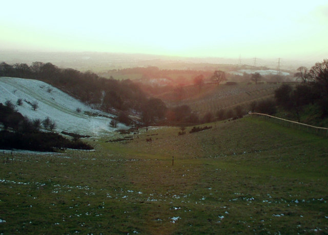
View south west from Windmill Hill, Waseley Hills Country Park
Weather for this location
Loading local forecast…
Nearby places
Useful places within 5 km
Own or manage this place?
Claim this listing to keep details accurate, add photos, and highlight what makes it special — free.
Claim this pageHow was your visit?
How useful was the information on this page?
id: 7ff9006d-7b3a-45a0-b435-848cdb64c419