Plan your visit
Getting here
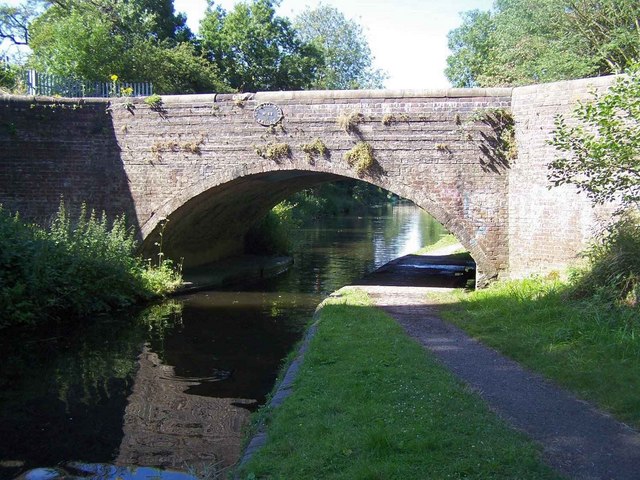
52.60319, -2.15241
Visiting this summer
Seasonal nature notes and what to look for now
Visiting this summer
Seasonal nature notes and what to look for now
- 🐦63+ species recorded in this area — summer evenings are best for activity; watch for Canada Goose and Coot
- 🐕Early mornings are best for dog walks in summer — visit before 9am to avoid the heat and find quieter trails
- 🅿️Parking on site — 20 car parks within reach
🌤️ Visiting this summer
- 🐦63+ species recorded in this area — summer evenings are best for activity; watch for Canada Goose and Coot
- 🐕Early mornings are best for dog walks in summer — visit before 9am to avoid the heat and find quieter trails
- 🅿️Parking on site — 20 car parks within reach
Good to know
- £Free to visit — no entry charge
- 🐕Dogs welcome
Best for
Bird watching
Very strong match
Birds — Canada Goose, Coot, Mute Swan +60 more · last seen 2026; Birds — Canada Goose, Coot, Mute Swan +60 more · last seen 2026
Wildlife
Very strong match
Multi-group wildlife — Birds, Mammals; Multi-group wildlife — Birds, Mammals
Seasonal nature
Strong match
Plants — Hogweed, Green Alkanet, Butterbur +33 more · last seen 2026; Plants — Hogweed, Green Alkanet, Butterbur +33 more · last seen 2026
Dog walks
Strong match
Dogs allowed — public woodland
Insect spotting
Strong match
Insects — 7-spot Ladybird, Harlequin Ladybird, Syrphus +18 more · last seen 2026; Insects — 7-spot Ladybird, Harlequin Ladybird, Syrphus +18 more · last seen 2026
Foraging
Good match
Deciduous woodland — fungi, berries and wild garlic; Plants — Hogweed, Flowering Currant, Hazel +3 more foraging species
Trails nearby
Within roughly 5 km🚶Walking
12 signed routes nearby
Signed route nearby
Walking
Monarch's WayWalking route990 km
approximate route of Charles II's escape
Staffordshire Way (Cannock Chase South)Walking route
Staffordshire Way, part Cannock Chase - south
Bilston to Loxdale Health WalkWalking route2.8 km
Self-guided health walk through Black Country Millenium Urban Forest sites. Route passes 15th century Greyhound & Punchbowl pub and Bradley Arm which is topped up by pumping water out of disused mines. Difficulty: Medium due to slopes Duration: 45-60 mins
ABCD War Heritage TrailWalking route
A short guide to some of the First and Second World War heritage of the All Saints and the Blakenhall area. This trail explores historic Wolverhampton sites associated with the periods 1914-1918 and 1939-1945.
All Saints' TrailWalking route
Heritage trail around the large former Parish of All Saints along a route traditionally church members would walk to beat set points with canes (known as 'Beating the Bounds) This formed a mental map of the area when maps were rare.
🚴Cycling
76 signed routes nearby
Signed route nearby
Cycling
[PROPOSED]Starley Regional Cycle NetworkCycling route804 km
Starley (TfWM) Regional Cycle Network (Proposed route)
National Cycle Network Route 81 (removed)Cycling route
South Staffordshire Railway WalkCycling route
Sneyd Junction to Horseley Fields JunctionCycling route9.6 km
Canalside route following the Wyrley & Essington, taking New Cross Bridge, where the towpath changes to the other side of the canal. Distance: 6 miles/9.6 km (approx) Duration: 60 min (approx)
Horseley Fields Junction to Factory JunctionCycling route8 km
This route begins and ends with a pub, and travels through Coseley Tunnel. To avoid the tunnel, leave the canal at Bridgewater Drive and return via Central Drive. Distance: 5 miles/8 km (approx) Duration: 45 min (approx)
Route 81Cycling route
Wildlife to spot
Photos
Weather for this location
Loading local forecast…
Nearby places
Useful places within 5 km
How was your visit?
How useful was the information on this page?
id: c98303a6-adc8-4d66-80ac-cd9ec42d2d64